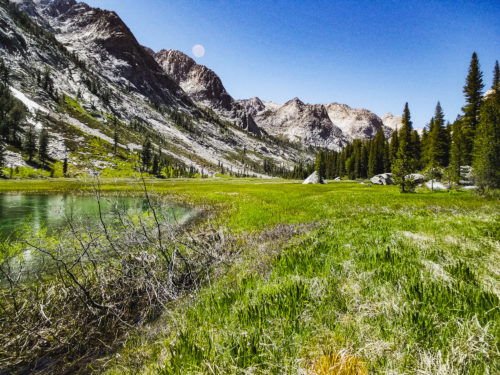
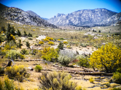
It has been close to 2 weeks since any sign of civilization. Even longer than that since we were last in a real town, and by real town I mean a place that doesn't run purely on generators as there is no electricity grid for them to connect to. For nearly 2 weeks now we have been hiking through the most continuously remote wilderness area in the entire lower 48 states. Through crystal clear rivers, snow capped mountain peaks, and vibrantly green forests, we have made our way through the Sierra Nevada.
Reunion
After 2 weeks away from the trail to celebrate my sister's graduation and spend some quality time with my girlfriend and my family, I made my way back to where I had left off. Leaving and coming back had a funny way of making me appreciate both more.
Congrats Emilia! See you later family!
Going home helped reinforce the relationships with my loved ones and remind me of all the parts of me that I've left behind. I was able to return to the trail excited about the life that I would be returning to when this trip reached it's end.
See you soon Jessie!
Likewise leaving and coming back to the trail gave it a greater sense of familiarity. When I first began the hike down at the Mexican border, there was this sense of foreignness to this experience and place I did not yet feel totally comfortable in. By returning after some time away, it has made the trail feel more like the home that I'm living in for the time being.
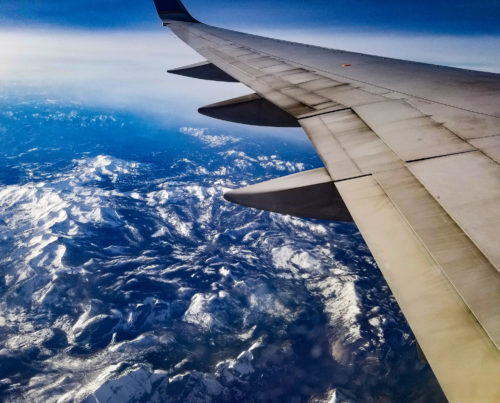
Flying over the Sierra Nevada.
After a plane ride and a couple of nauseating bus rides, I was back at Walker Pass and off hiking again. That day was defined by an unending car sickness that lasted until I fell asleep.
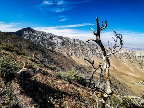
Climbing out of Walker Pass.
While technically part of the Sierra Nevada mountain range, the terrain I was in was more defined by that of the desert section of the Pacific Crest Trail. Chaparral plants, Joshua trees, blistering sun, and long stretches without water continued to be the forefront of my experience.
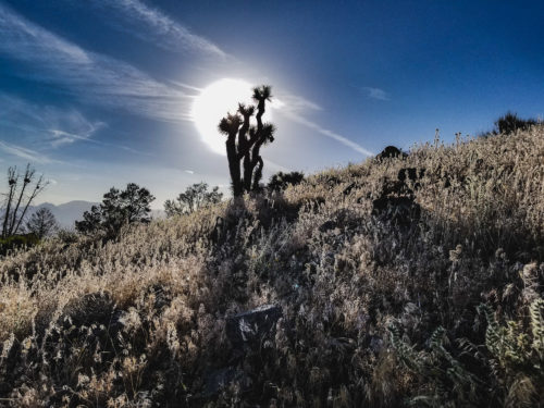
A lone Joshua tree stands amongst the chaparral.
Over the next few days I made my way towards Kennedy Meadows, known amongst PCT hikers as the Gateway to the Sierra Nevada. The environment around me became more and more remote. The distant city lights were steadily replaced by vast mountain ranges and my cell phone service dwindled away until it finally disconnected with no signs of returning.
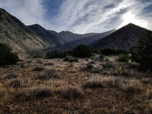
The desert foot hills of the Sierra Nevada.
After days hiking through the hot desert wilderness, I came into a beautiful chaparral meadow. It stretched out for miles, but in the distance I could make out a single paved road. An occasional car would drive by every 15 or so minutes, but otherwise no signs of people were to be seen. This was it, I had at last arrived in Kennedy Meadows.
The trail approaching Kennedy Meadows.
I made my way about a mile down the road when suddenly I hear clapping and a congratulatory "Woooo!" not to far away from me. Low and behold it's Dennis! Standing beneath a small cluster of trees in an otherwise shadeless region, he had been awaiting my arrival that day after having been in Kennedy Meadows by himself for the past 5 days.
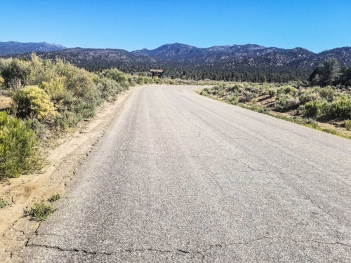
Walking along the one paved road.
We made our way to the General Store, also known as the only store in this town with a population of less than 200. The General Store is the main place where all of the hikers congregate before heading off into the Sierra. They sell burgers, beer, and expired dehydrated meals for hikers to take on the go.
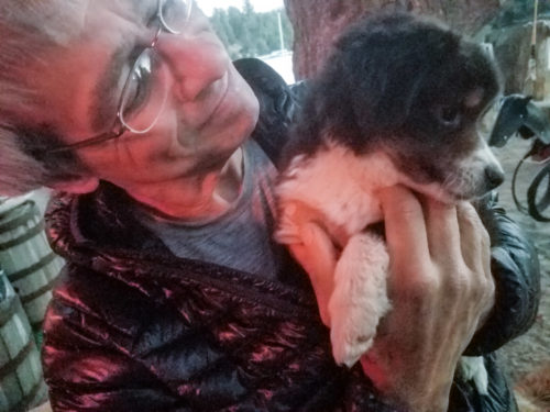
They also have a lot of puppies and dogs. Pictured here is Dennis playing with the smallest of said puppies.
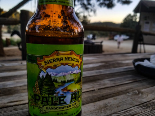
After we did some catching up and drinking some fitting Sierra Nevada beers, we started to formulate our plan for the coming section. We had two options to decide between. The first was to carry enough food for only a few days but we would have to spend two or more days just to go into a town to resupply and then back onto the trail. The second was to pack enough food for 13 days and go straight through the High Sierra in a single go, resupplying at a small resort connected to the trail by ferry at the end of the stretch.
We opted for choice 2.
Here we come.
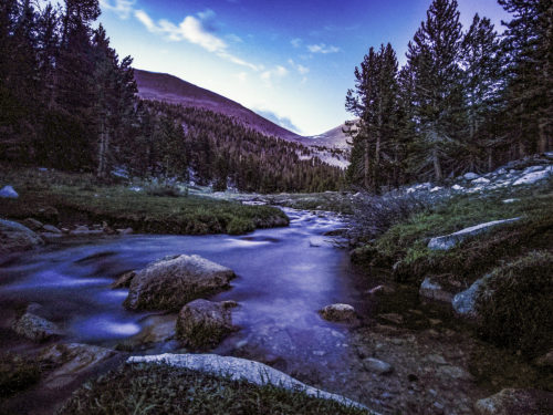
Chicken Spring Lake
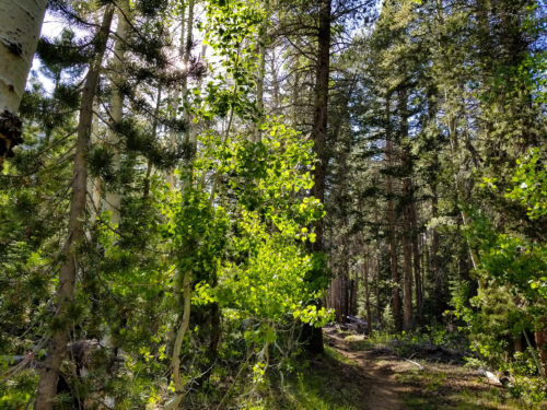
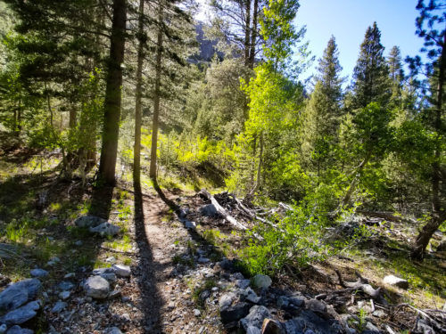
As we made our climb out of Kennedy Meadows, we once again watched the desert chaparral slowly transition into pine forests. The difference was that this time it would be for good.
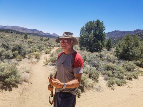
Dennis sports a new hat. He hates it already.
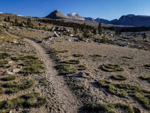
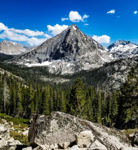
For several days we walked through alternating wide open pine forests and vast grassy meadow. Occasionally we would see some distant rocky peaks, it was all quite beautiful. However this was not the Sierra we had been expecting.
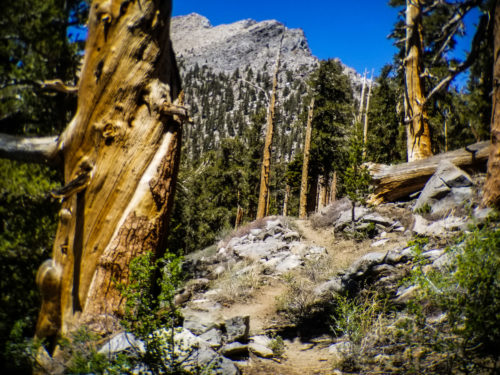
Rocky peaks jut out over open forests.
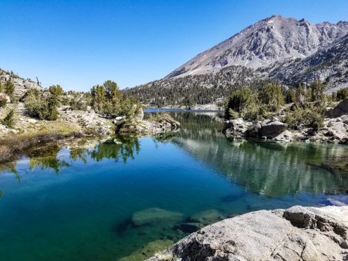
That started to change when we reached the questionably named Chicken Spring Lake. I hadn't heard of the Great Sierra Nevada Chicken before, so I wasn't sure where the name came from. Nevertheless, it was at this point when it finally began to feel like the High Sierra.
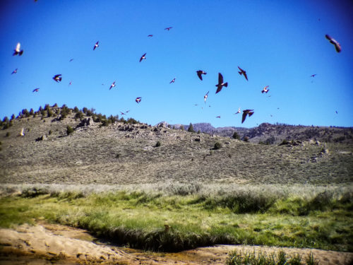
This meadow was filled with nesting birds under a nearby bridge.
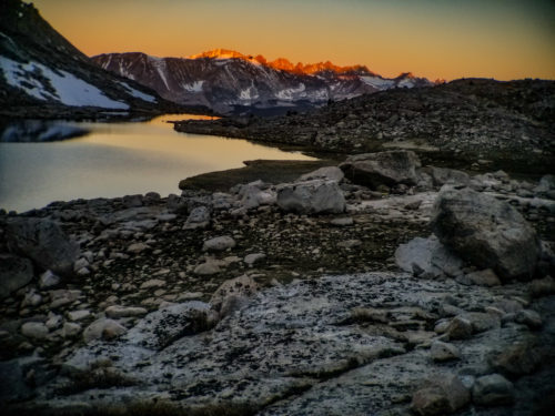
Looming over the lake was a massive granite peak, flaked with bits of snow still waiting to melt. The water was ice cold, but that didn't stop us from jumping in. It would be the closest thing to a shower we'd get for the next 10 days. We camped by the lake that night, thinking we were finally in the Sierra we expected. In hindsight, Chicken Spring Lake and it's huge rocky peak would pale in comparison to what would come next.
The dramatic Chicken Spring Lake.
The High Points
After the lake we made our way to the base of Mount Whitney. While not technically a part of the PCT, it is a must do trip that just about everyone does. At 14,505 feet, it is the tallest point in the lower 48 states. Being only 16 miles round-trip from the trail, how could one pass up such an opportunity?
A river running at Crabtree Meadows, the base camp everyone stays at before summiting Whitney.
The climb to the top was tough. The climb back down was even tougher. 16 mile hikes had become easy for us, but we underestimated Whitney. It was 8 miles practically straight up, and with each step there was just a little less oxygen in the air.
We watched the morning glow on the distant peaks as we hiked up Mount Whitney.
Every few minutes we would have to break to adjust to the altitude. When we finally made it to the top I was surprised to have phone service, the first of it in nearly a week and the last I'd have of it for over a week to go. I gleefully called my girlfriend, it was a moment of joy after not hearing each other for so long. As I talked I could feel myself getting out of breath purely from speaking, the high altitude affected me more than I even realized.
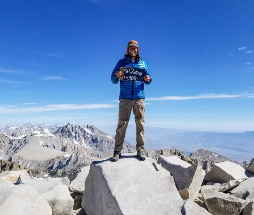
Standing at the highest point in the lower 48!
The view was incredible, we could see the Sierra Nevada stretch out forever. It was a sneak preview for what was to come, yet even the endless snow capped peaks reaching into the heavens and the horizon didn't prepare us for what was coming.
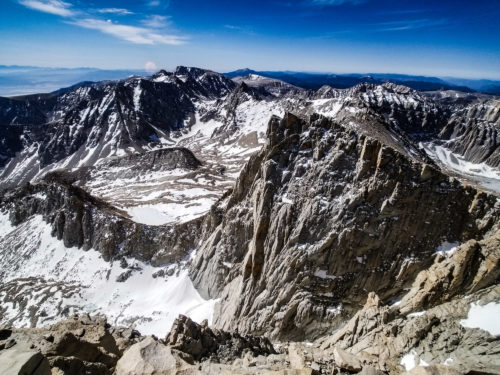
Jagged rocky peaks stretched out forever in every direction
We thought the descent would be easier, after all we would be gaining oxygen. Yet somehow it felt like it took twice as long as the ascent. By the time we reached the bottom we were completely wiped. Unfortunately for us there was little rest to be had. We had 7 more miles go so we could set ourselves up for the first and biggest pass we would be climbing.
Hiking down off Whitney. Do you see the lake that looks like a guitar?
Forrester Pass is the highest point along the PCT, reaching over 13,000 feet. From reports we knew it was covered in snow on both sides, and the best time to tackle those conditions is in the coldness of the morning. If you hit the snow in the afternoon, it will be warm and soft and every step you take you risk sinking down to your waist. So it's better to go when it's still frozen and hard and just wear some traction to keep you from slipping.
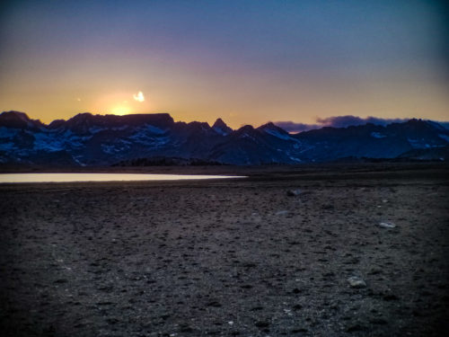
On our way over we caught an amazing sunset over the mountains.
The First Pass
We were up at day break, tired and weary from the long day before, but ready to tackle Forrester Pass regardless. As we ascended to the base of the pass, the forests became thinner and the trees smaller. Rocky summits that dwarfed city skyscrapers began to surrounded us.
Climbing out of the forests.
Eventually the flora gave way entirely for a wide open tundra. Granite, snow, and streams of water stretched out for miles, making their way across the open expanse and climbing to the tops of the surrounding mountains.
Isn't it supposed to be June?
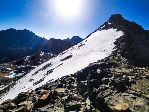
In the distance the trail appeared to walk straight into a vertical cliff. Dennis pointed at it and exclaimed that it was Forester Pass. I was confused, we were looking at a near 90° wall of rock, how could that be the trail? After more pointing and explaining, I was able to make a thin line zigzagging up the cliff. The trail had literally been carved out of the side of this giant wall, and we were going straight up it.
Yeah the trail goes through the middle of that...
A Wild and Rugged Place
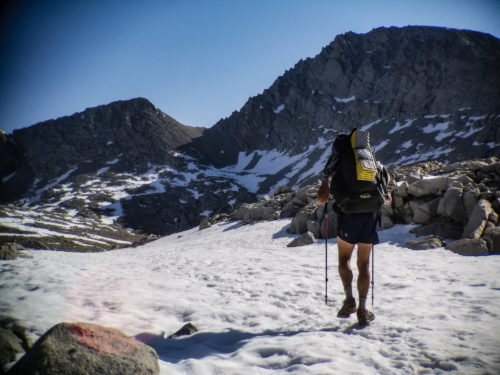
The climb was tough, especially after the long day before. It also gave us a chance to finally use the ice axe and micro spikes we had been carrying for days.
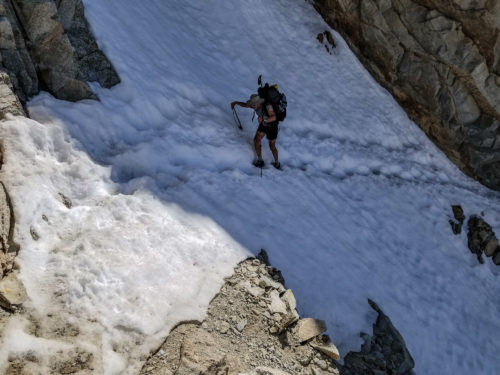
Don't look down!
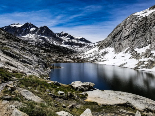
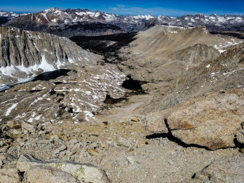
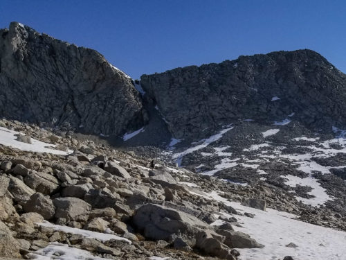
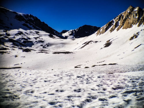
When we finally got to the top and looked out at the other side, our jaws dropped. At our feet was a solid bank of untouched snow that expanded for 1000 feet above us and another 2000 feet below. Where the snow stopped beneath us the ground leveled out into a wide open tundra. In the center was a crystal blue glacial lake, with water clearer than that seen in the Caribbean. As our eyes continued forward we saw as the tundra descended into a valley, with evergreens filling it from side to side for tens of miles. At the edges of the valley rose towering, snow covered mountains, dwarfing all that was below. This, finally, was the High Sierra.
Looking out over the backside of Forrester Pass.
For the next several days we would climb over many of these passes. Our schedules became dictated by them. It was best to hike them in the morning, so the pattern was to hike up early, then make our way to bottom of the next one by nightfall.
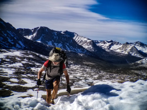
Ascending over another pass.
In between the passes we would descend thousands of feet through the tundras and into the lush forests. Evergreens, aspens, and wildflowers would line the trail. Marmots crawled about and deer grazed peacefully on the grasses. We walked by lakes and meadows, and life was abundant everywhere. The views from the top would take my breath away, but the forests warmed my soul.
I'm sure some of my love for the forests come from my New England upbringing and some come from the influence of my girlfriend and her love of trees.
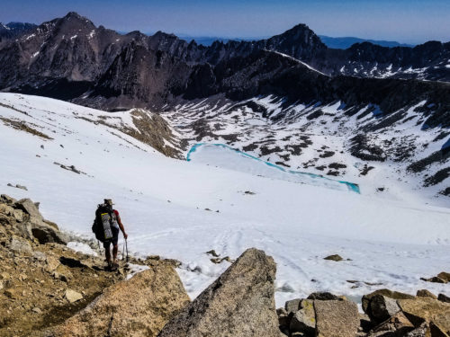
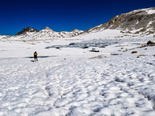
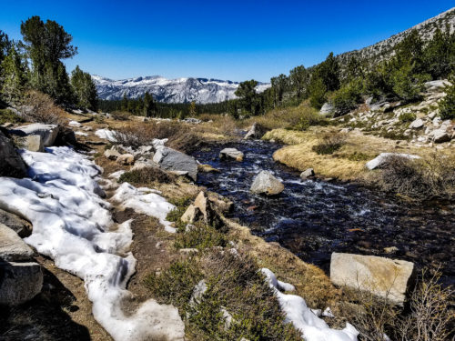
There was also water. A lot of water. Unlike the desert where we were constantly planning around when we would get our next fill up, water became an after thought in the Sierra. We were never more then 30 minutes from a stream, and it wasn't uncommon that the trail itself would be that stream.
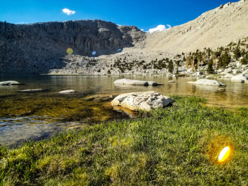
Beautiful alpine lakes were also plentiful. They provided water both to drink and to swim in.
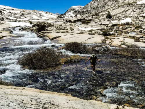
We also had to deal with river crossings. They usually didn't go above the knee, but there were a couple that reached the thigh. Past years had hikers having to swim across to get to the trail on some of the rivers, we thanked our lucky stars for a much tamer year.
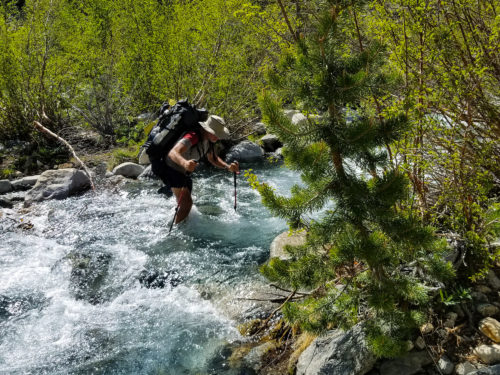
Carefully crossing a river.
I can share these pictures of the Sierra to help illustrate what it was like, but the pictures can't show it all. They can't show the sounds of the raging snow melt rivers that constantly drummed in the distance while songbirds sang the vocals. They can't show the smell of pine and wildflowers filling the air or the taste of cold water dipped right out of a glacial lake. They can't show what it felt like to be dwarfed by everything around, to truly feel the scale and size of the mountains and trees as you walk through, just an observer to this wild and rugged place.
Muir Pass
The second to last and hardest pass we would go over was Muir Pass. It was named after the famous explorer, John Muir, who is most known for spending much of his life exploring the Sierra Nevada. He called the place "the Range of Light", for not only is it sunny most of the year, but the way the light reflects off the many rivers, lakes, snow fields, and granite peaks brings about a brilliant shine everywhere you look.
Light reflects off the snow and rocks.
What made this pass so hard was the snow was not just some scattered sections around the top, but rather snow that lasted for miles in every direction. We hit the ascent early, and it felt like we could have been in the Himalayas. Everywhere we looked there was snow, broken up only by small patches of granite or ice covered lakes. It was a cold and barren place.
The wide open expanse heading up Muir Pass.
Our morning start got us to the top with no issues, but by then the snow was starting to warm and soften. As we made our way down, the postholing that would define the next 4 hours of our life began.
The other side of Muir Pass. Snow for miles.
Postholing is when you take a step on soft snow and instead of supporting you, it gives out and you sink down to your knees, sometimes as deep as your waist. Every step feels like a land mine waiting to go. If you posthole once, you're twice as likely to posthole again trying to climb out of the snow. To make matters worse, many of these weak spots are caused by small ice water streams under the snow. So each time you sink there's a good chance your foot is getting soaked with freezing cold water.
We took a long break to dry our shoes once we were through with the snow. But just minutes after beginning to hike again we had to cross a river...
The Other Side
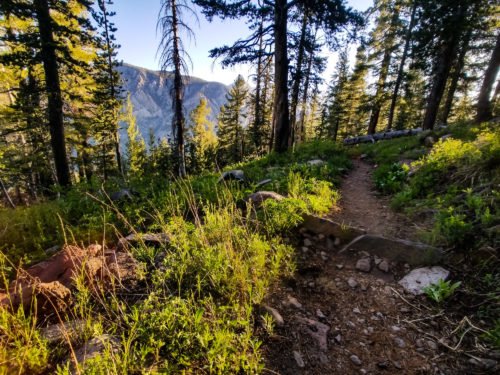
After conquering Muir Pass, the trail began to become tamer. We descended into the woods for a long while before making the ascent to the final pass, Selden Pass, we would hit during this stretch.
Back into the beautiful green forest.
Selden Pass proved to be easier than all the others. It was less steep and had very little snow. The views were still stunning, but the intensity level seemed to be dialed back a few notches. The mountains were big, but not the same throne-of-the-gods feeling that was present with the others.
Views along the way up to Selden Pass
We descended down and into forests once more. As we made our way to our campsite, we could see mountains in the distance not capped with granite and snow, but with trees. For the first time in days we could see the sky instead of cliffs as we looked forward. Dennis and I sat and reflected as we watched the sun set over these smaller mountains. While there was still much left of the Sierra Nevada, it felt like we had pushed beyond the part known as the High Sierra.
Descending through the forest.
These past 2 weeks had felt like a month. Everything about it was intense- the uphill, the downhill, the views, the water, the snow, everything. Hiking through and immersing ourselves in this untamed wilderness was truly a once in a lifetime experience. It was hard, very hard, and while we're both ready for some easier terrain, we will always remember our time through the High Sierra.